SIMBIO-SYS - BepiColombo
simbio-sys
spectrometer and imagers for MPO bepicolombo integrated observatory system

science goals
SIMBIO-SYS is an integrated suite for the imaging and spectroscopic investigation of the Hermean surface. The science goals of SIMBIO-SYS are to examine the surface geology (stratigraphy, geomorphology), volcanism (lava plain emplacement, volcanoes identification), global tectonics (structural geology, mechanical properties of lithosphere), surface age (crater population and morphology, degradation processes), surface composition (maturity and crustal differentiation, weathering, rock forming minerals abundance determination), and geophysics (libration measurements, internal planet dynamics) of Mercury. It incorporates capabilities to perform medium space resolution global mapping in stereo and colour imaging using two pan-chromatic and 3 broad-band filters, respectively, as well as high spatial resolution imaging in a pan-chromatic and 3 broad-band filters and imaging spectroscopy in the spectral range 400–2000 nm.
measurement principle
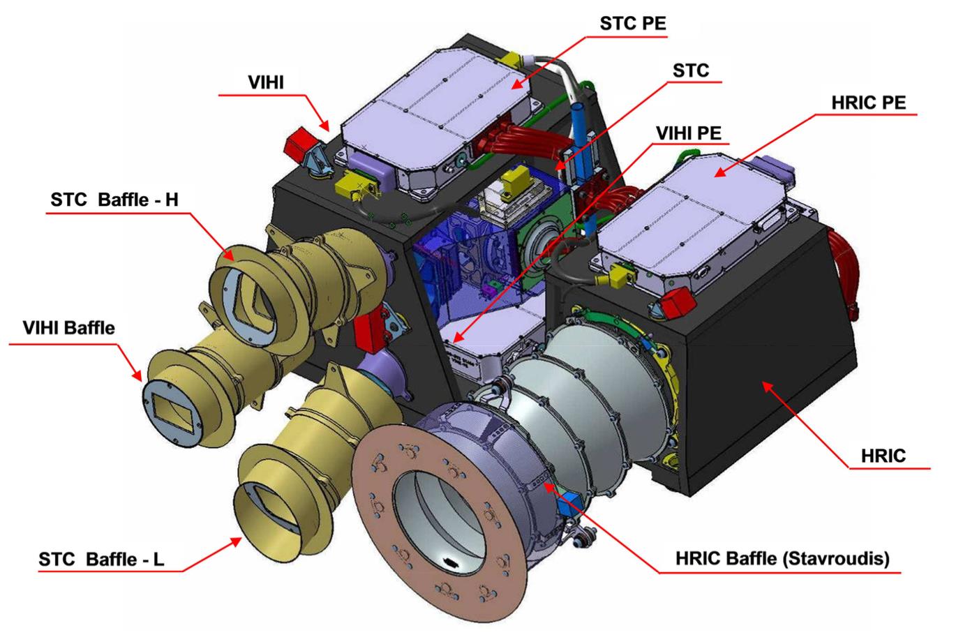
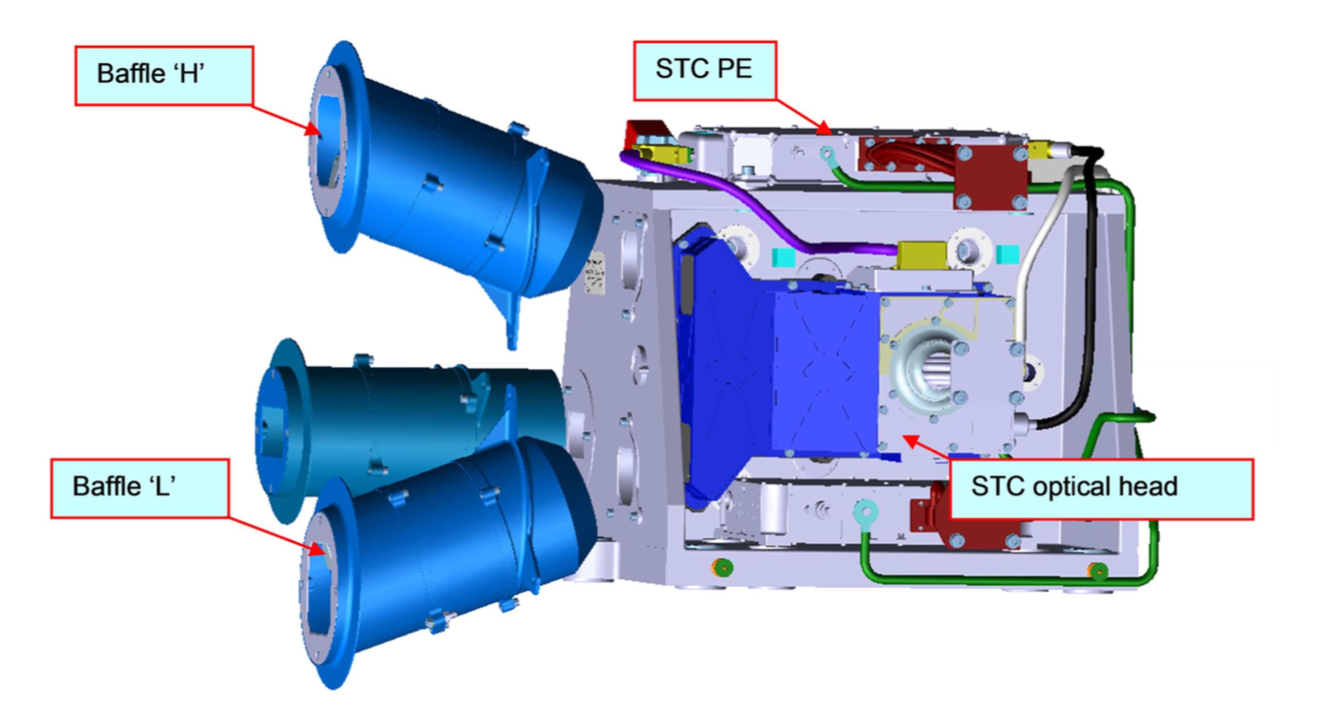
STC – Stereo Channel: The STC channel will provide global colour coverage of the surface in full stereo at 60 m/pixel resolution, at 480 km from the surface, with the aim of defining the main geological units, large scale tectonic features, impact crater population and, if present, volcanic edifices. It will be a useful tool to define with high detail the topography, which is a critical measurement for tectonic features characterization, geological units lateral boundaries definition and for measuring important geophysical parameters. The STC will also provide the context for the HRIC. The main objectives are global mapping in stereo mode at spatial resolution of < 120 m, with maximum resolution of 60 m per pixel and global mapping in three colours at spatial resolution of < 120 m. The FOV of the STC is 5º and it will have four spectral channels (panchromatic (650) + 550, 700, 880 nm).
HRIC – High spatial Resolution Imaging Channel: The main objective of HRIC is the characterization of special surface targets with high resolution. It will provide images at ground pixel sizes of 6 m/pixel from altitude of 480 km, to provide high spatial resolution images of selected regions from more than 10% of the surface, and to provide high spatial resolution images in four different bands. Its FOV is 1.47º and the spectral range is 400–900 nm. The spectral range as well as the spectral channels are the same as those of STC. The sensors are based on active pixel (APS) detectors.
VIHI – Visible Infrared Hyperspectral Imager Channel: VIHI is a hyperspectral imager in the visible and near-infrared range that will map the planet in order to provide the global mineralogical composition of the surface. The selected spectral characteristics (range 400 – 2000 nm with possible extension to 2200 nm and spectral sampling 6.25 nm) and the imaging capability (IFOV 250 µrad, which translates into a 120 m spatial resolution at 480 km) will permit the unambiguous cross-correlation of the surface composition with the morphological features. The main objectives are to produce global mineralogical mapping at spatial resolution better than 480 m; to identify mineralogical species at a 5-10% confidence level, and to correlate surface composition and surface features at a scale of 480 m globally and up to 120 m in selected places (> 5% surface coverage). VIHI is designed as a push-broom spectrometer with a FOV of 3.7º.
additional images


LINK TO SCIENCE DATASETS - COMING SOON
LINK TO USER MANUAL
- Removed a total of (3) style text-align:center;


 Sign in
 Science & Technology
